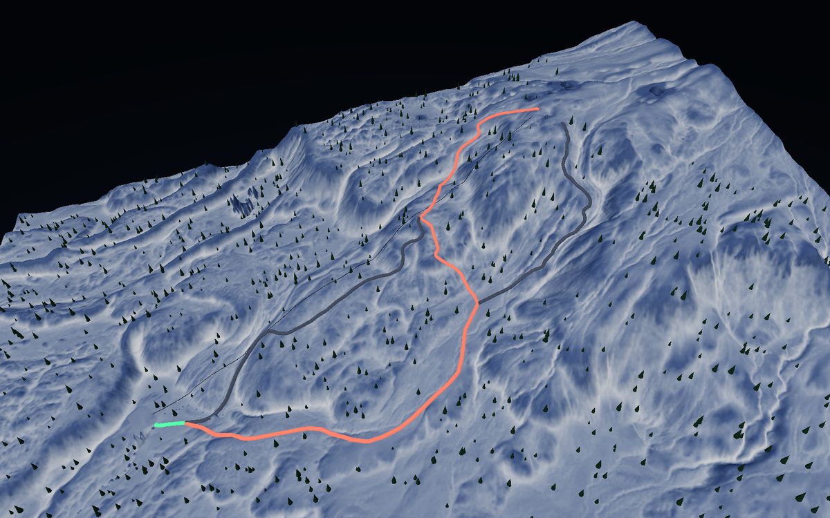
Resorts
Hokkaido's big resorts, in game-grade 3D.
Runs, lifts and terrain at a glance — nine resorts you can spin, tilt and test-ride before you pick today's mountain.
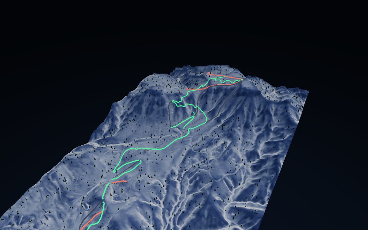
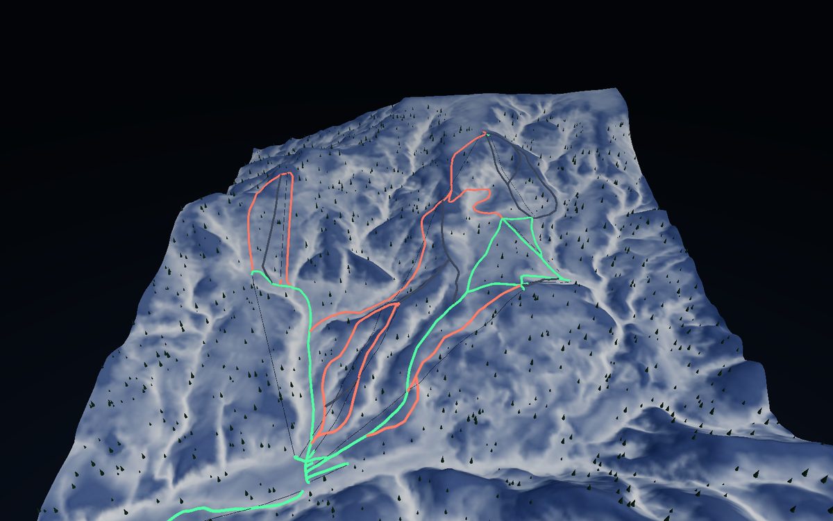
Sapporo Teine
Sapporo · Vertical 860m
Closest to Sapporo · Olympic-legacy terrain
⛰ View the 3D map →
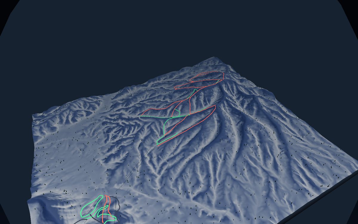
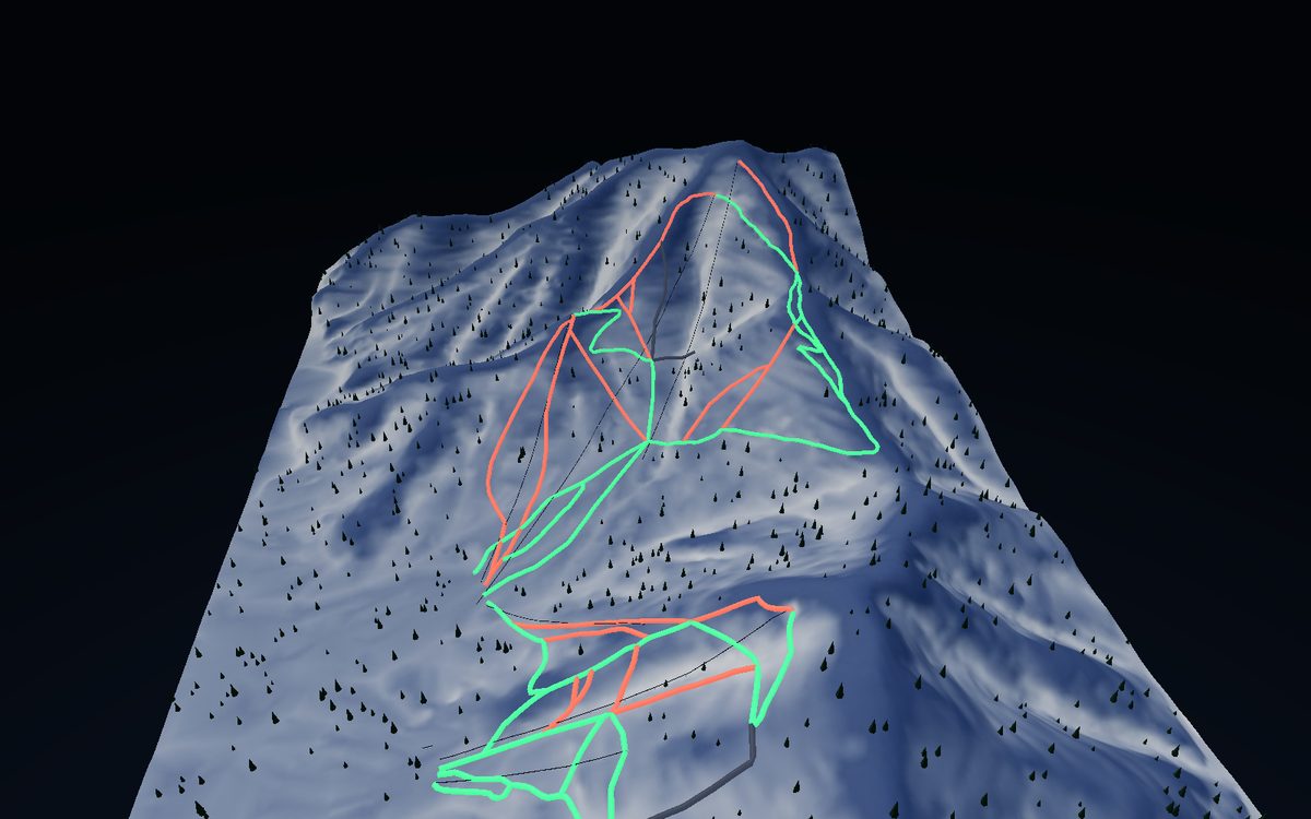
Rusutsu
Shiribeshi · Vertical 685m
Tri-mountain resort · legendary powder
⛰ View the 3D map →
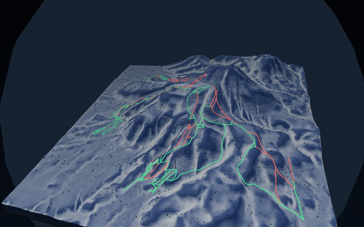
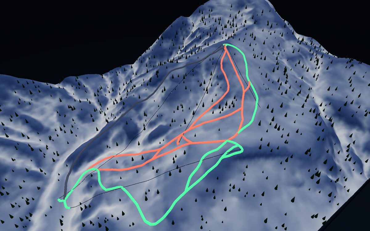
Niseko United
Shiribeshi · Vertical 1140m
World-class powder · the legendary four-mountain united area
⛰ View the 3D map →
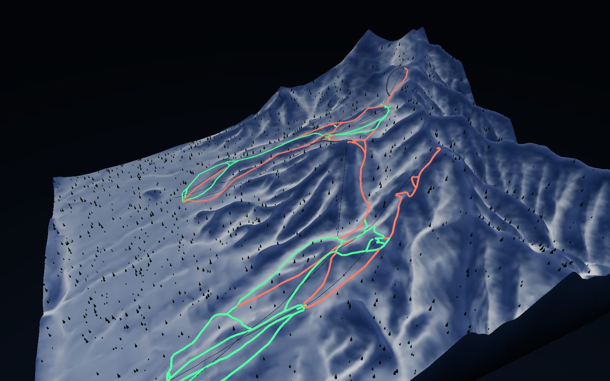
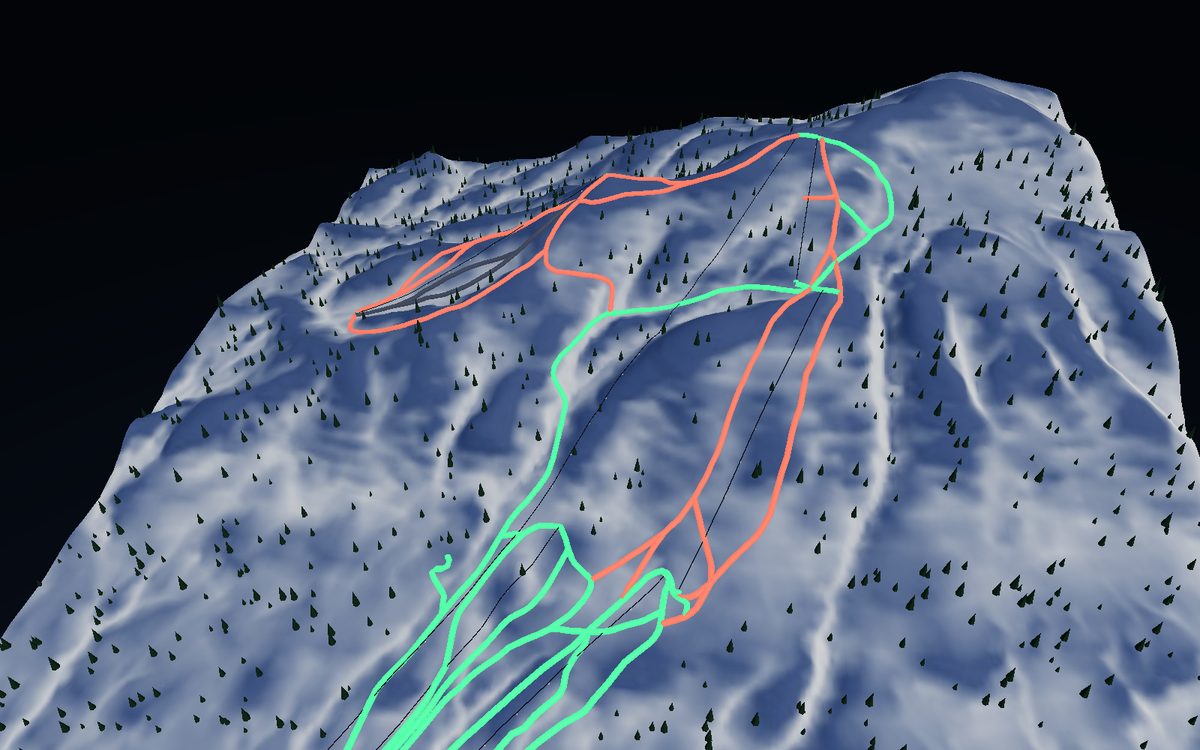
Furano
Furano · Vertical 1000m
Near 1000m vertical · dry inland powder
⛰ View the 3D map →
Kiroro
Akaigawa · Vertical 821m
Huge snowfall · one of Hokkaido’s deepest
⛰ View the 3D map →
Hoshino Tomamu
Shimukappu · Vertical 730m
Sea-of-clouds resort · family friendly
⛰ View the 3D map →
Sapporo Kokusai
Sapporo · Vertical 727m
Near Sapporo · wide groomers, reliable snow
⛰ View the 3D map →
Kamui Ski Links
Asahikawa · Vertical 724m
Asahikawa’s local gem · wide powder faces
⛰ View the 3D map →
Asahidake
Daisetsuzan · Vertical 1091m
Hokkaido’s highest peak · backcountry powder mecca
⛰ View the 3D map →