Niseko Annupuri · Routes
↘ Annupuri — Kita-shamen / Goshiki Loop
This route carries serious backcountry hazards. Its slope and ATES labels are planning estimates; they do not decide whether it is safe today or suitable for your group.
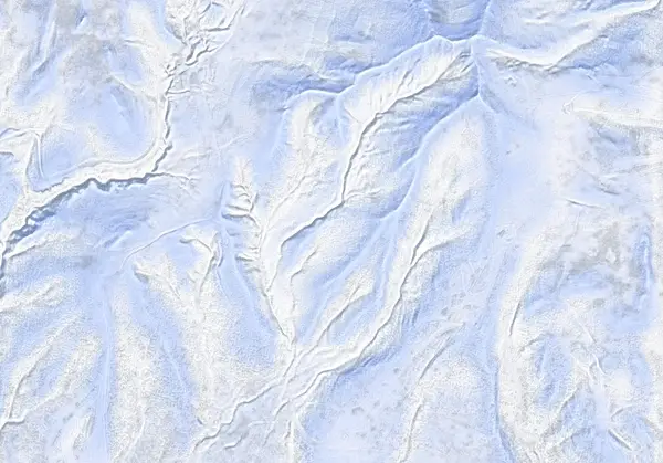 出典:国土地理院(標高タイル DEM10B を加工して作成)
Steepness · profile
← Distance 6.8 km →
Per-segment terrain (data table)
| % | m | Steepness | Aspect |
|---|---|---|---|
| 0% | 1151 | 34° | SE |
| 3% | 1229 | 34° | S |
| 6% | 1291 | 37° | E |
| 10% | 1280 | 37° | SW |
| 13% | 1294 | 33° | N |
| 16% | 1207 | 36° | N |
| 19% | 1093 | 37° | N |
| 23% | 972 | 31° | N |
| 26% | 875 | 29° | N |
| 29% | 800 | 22° | N |
| 32% | 768 | 34° | N |
| 35% | 780 | 33° | NW |
| 39% | 786 | 16° | N |
| 42% | 790 | 8° | S |
| 45% | 798 | 6° | E |
| 48% | 800 | 16° | SE |
| 52% | 784 | 17° | W |
| 55% | 764 | 17° | SW |
| 58% | 744 | 16° | W |
| 61% | 763 | 21° | W |
| 65% | 792 | 21° | W |
| 68% | 818 | 25° | W |
| 71% | 843 | 37° | SW |
| 74% | 735 | 39° | SW |
| 77% | 684 | 39° | SW |
| 81% | 638 | 23° | SW |
| 84% | 614 | 21° | SW |
| 87% | 591 | 28° | S |
| 90% | 560 | 28° | W |
| 94% | 533 | 11° | S |
| 97% | 512 | 18° | S |
| 100% | 486 | 16° | SW |
Route guide
The Kita-shamen / Goshiki Loop on Niseko Annupuri (1308 m) is a roughly 7 km lift-assisted circuit: ride the Annupuri gondola, skin the short remainder to the summit (about 250 m of climbing), ski the famous north face, follow the snowed-in Goshiki road to Goshiki Onsen, then climb back over toward the ski-area side. The skinning is short but the terrain is classified ATES Complex (Level 3) — unambiguous avalanche terrain. Read this as a description of the ground, not a recommendation.
[Gates to summit, ~1150–1308 m] Leave the ski area through the official Niseko Rules gates only — exiting anywhere else violates the Niseko Rules. Beacon, shovel and probe are mandatory. The summit dome is wind-exposed, builds wind slab readily, and the open ground around the primitive refuge hut is easy to lose orientation on in poor visibility.
[The north face (kita-shamen), ~1308 → ~770 m] The route's centrepiece drops north from the summit — one of the most popular backcountry zones in Niseko, reaching about 41° at its steepest. The northerly aspect keeps the snow cold and dry, but it is also a lee face that loads with wind-drifted snow. On a sunny weekend it will be heavily tracked; traffic is not stability. Make your own assessment.
[Goshiki Onsen and the return] The descent runs out onto the snowed-in Route 58 corridor, an easy skin/skate below Iwaonupuri's volcanic cone to Goshiki Onsen (~740 m) — a mid-tour soak is the classic move. From the onsen you climb back over toward the ski area to close the loop. The second half is mostly gentle treed terrain, but plan around the gondola and lift hours.
[Caution] Annupuri's summit is a rounded dome with similar-looking slopes on every side; in flat light it is easy to drop the wrong aspect. Confirm your descent bearing with GPS/compass, and check the day's Niseko Avalanche Institute bulletin before you go.
Access & logistics
Start & parking: Annupuri Ski Area base (ample parking). Ride the gondola up and exit through the official Niseko Rules gates; check gate status on the day via the Niseko Avalanche Institute bulletin and resort postings.
Getting there: 10–20 minutes by car from Niseko / Kutchan; expect packed snow and ice on winter roads.
Equipment & rules: Beacon, shovel and probe are mandatory. Beyond the gates you are in unmanaged backcountry. Plan the loop within gondola operating hours.
Onsen: Goshiki Onsen mid-loop (day-use bathing); more options around Annupuri base (e.g. Ikoi-no-yu) after. Hours vary by season — confirm locally.
Today / tomorrow briefing
Loading…
Set reminders inside Google Calendar
Hokkaido Wilds · Rob Thomson — HokkaidoWilds.org · CC BY-SA 4.0
A planning aid, not a verdict. Always check the day’s official avalanche bulletin and decide in the field.
Route data source: Rob Thomson — HokkaidoWilds.org · CC BY-SA 4.0 · ↓ Download GPX