Biei-dake · Routes
↘ Biei-dake — Karasawa Sagan Ridge
This route carries serious backcountry hazards. Its slope and ATES labels are planning estimates; they do not decide whether it is safe today or suitable for your group.
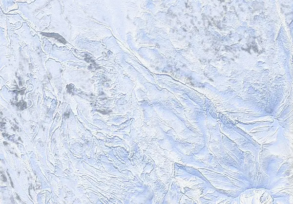 出典:国土地理院(標高タイル dem5a + DEM10B を加工して作成)
Steepness · profile
← Distance 14.0 km →
Per-segment terrain (data table)
| % | m | Steepness | Aspect |
|---|---|---|---|
| 0% | 650 | 15° | SW |
| 3% | 678 | 16° | N |
| 6% | 703 | 29° | N |
| 10% | 761 | 16° | SW |
| 13% | 810 | 40° | NW |
| 16% | 835 | 20° | N |
| 19% | 923 | 28° | NW |
| 23% | 952 | 15° | SW |
| 26% | 1003 | 30° | NW |
| 29% | 1118 | 18° | NW |
| 32% | 1202 | 23° | W |
| 35% | 1306 | 29° | NW |
| 39% | 1446 | 31° | W |
| 42% | 1553 | 32° | NW |
| 45% | 1703 | 33° | NW |
| 48% | 1868 | 51° | NW |
| 52% | 2038 | 50° | W |
| 55% | 1823 | 39° | NW |
| 58% | 1664 | 33° | N |
| 61% | 1520 | 31° | N |
| 65% | 1409 | 27° | W |
| 68% | 1281 | 23° | NW |
| 71% | 1194 | 18° | NW |
| 74% | 1113 | 30° | NW |
| 77% | 1000 | 15° | NW |
| 81% | 952 | 25° | W |
| 84% | 921 | 20° | NW |
| 87% | 836 | 40° | NE |
| 90% | 811 | 15° | NW |
| 94% | 763 | 29° | W |
| 97% | 706 | 18° | N |
| 100% | 679 | 15° | NW |
Route guide
The Karasawa Sagan Ridge climbs Biei-dake — a 2052 m stratovolcano northeast of Tokachi-dake — as an out-and-back up its northwest ridge from the Shirogane Onsen side. Hokkaido Wilds gives ~14 km, ~1450 m, and a difficulty of 8/10 — among the most committing on this site. The bake reads the aspect as northwest (NW), with a line median of ~16°, a maximum of ~46°, and an ATES rating of 'complex.' Read this as a description, not a recommendation.
[Terrain] From the end of snow clearing at Shirogane Onsen (parking: 43.4767°N, 142.6509°E), skin southeast, cross a creek, and climb through planted conifers set out in rows. Past the 'Treeline ends abruptly' waypoint the route breaks suddenly into the alpine; via a 'sheltered(ish) gully' it gains a wind-scoured northwest ridge to the summit. Up high, rime ice forms — ski crampons, and sometimes boot crampons, are needed.
[The main hazards are exposure, remoteness and wind] South of the summit the Ponpi-sawa basin drops away — a cathedral of chutes and rock spurs, with a precipitous fall to the south directly off the summit. The source names navigation on the wind-scoured ridge, rime ice, and a remoteness so complete you are 'unlikely to see anyone else on the route' as the defining risks. Drop the wrong way south on the descent and you are in another world. Biei-dake is also part of the JMA-monitored Tokachidake volcanic group. Check the JMA Tokachidake volcano bulletin and the Japan Avalanche Network Central Hokkaido bulletin before departing, and make your own stability assessment.
Access & logistics
Start & parking: The winter end-of-plowing at Shirogane Onsen (parking: 43.4767°N, 142.6509°E). Roadside space depends on plowing.
Getting there: A car is the practical option, from the Biei / Shirogane Onsen side. Expect snow and ice in winter — 4WD with winter tyres.
The day: ~14 km, ~1450 m — one of the biggest climbs on this site. Above treeline onto the northwest ridge; descend the ascent line. Start early in short winter daylight.
Gear: Ski crampons essential (rime ice), boot crampons possible. Carry reliable navigation and be self-sufficient for the exposed ridge and remoteness.
Info: Check the JMA Tokachidake volcano bulletin and the Japan Avalanche Network Central Hokkaido bulletin before departing.
Today / tomorrow briefing
Loading…
Set reminders inside Google Calendar
Hokkaido Wilds · Rob Thomson — HokkaidoWilds.org · CC BY-SA 4.0
A planning aid, not a verdict. Always check the day’s official avalanche bulletin and decide in the field.
Route data source: Rob Thomson — HokkaidoWilds.org · CC BY-SA 4.0 · ↓ Download GPX