Chisenupuri · Routes
↘ Chisenupuri — South Face
This route carries serious backcountry hazards. Its slope and ATES labels are planning estimates; they do not decide whether it is safe today or suitable for your group.
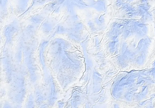 出典:国土地理院(標高タイル DEM10B を加工して作成)
Steepness · profile
← Distance 5.6 km →
Per-segment terrain (data table)
| % | m | Steepness | Aspect |
|---|---|---|---|
| 0% | 552 | 8° | NW |
| 3% | 551 | 16° | SE |
| 6% | 576 | 28° | S |
| 9% | 602 | 28° | S |
| 13% | 637 | 19° | E |
| 16% | 653 | 29° | E |
| 19% | 671 | 29° | E |
| 22% | 708 | 32° | SE |
| 25% | 752 | 30° | S |
| 28% | 803 | 17° | W |
| 31% | 827 | 24° | N |
| 34% | 829 | 26° | S |
| 38% | 869 | 15° | S |
| 41% | 892 | 22° | S |
| 44% | 945 | 31° | S |
| 47% | 1021 | 33° | S |
| 50% | 1108 | 34° | S |
| 53% | 1101 | 33° | S |
| 56% | 1018 | 31° | S |
| 59% | 943 | 22° | S |
| 63% | 892 | 15° | S |
| 66% | 868 | 26° | S |
| 69% | 827 | 20° | S |
| 72% | 827 | 17° | N |
| 75% | 797 | 30° | W |
| 78% | 752 | 32° | S |
| 81% | 709 | 28° | SE |
| 84% | 672 | 28° | E |
| 88% | 656 | 19° | E |
| 91% | 640 | 24° | E |
| 94% | 616 | 28° | SE |
| 97% | 580 | 16° | SE |
| 100% | 554 | 11° | SE |
Route guide
The south face of Chisenupuri (1134 m) is the classic tour of the central-west Niseko Range: from the old Chisenupuri ski area carpark (~680 m, now a cat-skiing operation) up the marked public uptrack, then the south-southeast ridge to the summit — about 5.6 km, 542 m, 3 hours (2 up, 1 down), graded 4/10 by Hokkaido Wilds. It is generally regarded as the lowest-avalanche-risk line on this mountain, but there is no patrol and no avalanche control: you are on your own. Read this as a description, not a recommendation.
[The climb] The defunct ski area is leased by The House of Powder, who run a cat-skiing operation and have maintained good relations with ski tourers for years — respect that by keeping to the marked public uptrack (orange tape, skier's left of the old runs). A one-time snowcat lift to the top of the cat area is available at 8 am for ¥2,000. From the derelict lift station (832 m) the route crosses a plateau (~870 m) and climbs the SSE ridge to the summit. Expect hard crust and rime near the top.
[The descent] Retrace the ascent line. In late season watch the cornice that develops looker's left of the summit.
[No-go terrain] The eastern face above treeline is described as 'classic Hokkaido avalanche terrain', and the east-side slopes above the Oyunuma hot pond carry multiple no-entry waypoints (included in the GPX). Stay off the east face. Check the Niseko avalanche bulletin and the JAN SW Hokkaido bulletin before departing, and make your own stability assessment.
Access & logistics
Start & parking: The Niseko Chisenupuri ski-area carpark (42.8677, 140.5964). Large, but fills on fine weekends — arrive early.
Getting there: ~5 km west of Niseko United. No public transport; a taxi from Hirafu is about ¥6,500 one-way.
Rules: Within the cat-skiing area, use the marked public uptrack (orange tape) only. A one-time 8 am snowcat ride to the top of the cat area costs ¥2,000.
Onsen: Yukichichibu (¥700; restaurant 11:30–15:00), famous for its mud-infused baths, is right nearby. Confirm hours locally.
Info: Check the Niseko avalanche bulletin and the JAN SW Hokkaido bulletin before departing.
Today / tomorrow briefing
Loading…
Set reminders inside Google Calendar
Hokkaido Wilds · Rob Thomson — HokkaidoWilds.org · CC BY-SA 4.0
A planning aid, not a verdict. Always check the day’s official avalanche bulletin and decide in the field.
Route data source: Rob Thomson — HokkaidoWilds.org · CC BY-SA 4.0 · ↓ Download GPX