Mekunnai-dake · Routes
↘ Mekunnai-dake — South Face
This route carries serious backcountry hazards. Its slope and ATES labels are planning estimates; they do not decide whether it is safe today or suitable for your group.
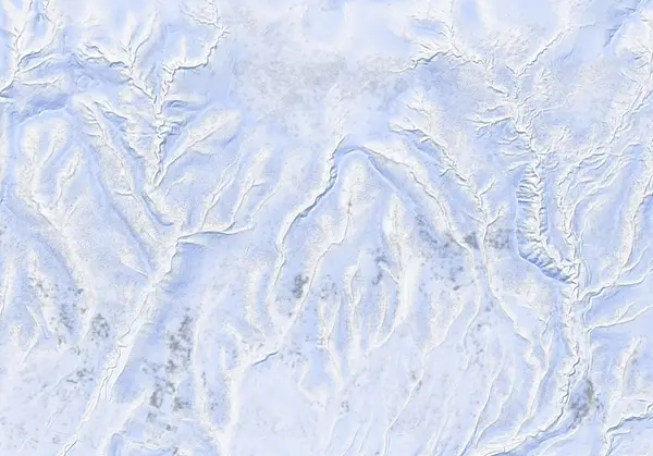 出典:国土地理院(標高タイル DEM10B を加工して作成)
Steepness · profile
← Distance 13.5 km →
Per-segment terrain (data table)
| % | m | Steepness | Aspect |
|---|---|---|---|
| 0% | 164 | 7° | S |
| 3% | 189 | 20° | SW |
| 6% | 240 | 27° | S |
| 10% | 327 | 13° | SW |
| 13% | 349 | 16° | SE |
| 16% | 399 | 16° | SW |
| 19% | 452 | 12° | S |
| 23% | 496 | 13° | SW |
| 26% | 549 | 17° | W |
| 29% | 631 | 15° | SW |
| 32% | 714 | 22° | SW |
| 35% | 823 | 23° | S |
| 39% | 878 | 13° | SE |
| 42% | 915 | 12° | W |
| 45% | 945 | 23° | SW |
| 48% | 1057 | 23° | SW |
| 52% | 1187 | 30° | SW |
| 55% | 1149 | 23° | SW |
| 58% | 1019 | 22° | S |
| 61% | 926 | 8° | SW |
| 65% | 905 | 13° | S |
| 68% | 864 | 23° | E |
| 71% | 772 | 21° | SW |
| 74% | 679 | 16° | SW |
| 77% | 589 | 17° | W |
| 81% | 518 | 10° | SW |
| 84% | 473 | 14° | S |
| 87% | 418 | 16° | S |
| 90% | 362 | 11° | SE |
| 94% | 336 | 27° | NW |
| 97% | 260 | 27° | S |
| 100% | 204 | 10° | W |
Route guide
The south face route on Mekunnai-dake (1220 m) climbs the quiet gem at the western end of the Niseko Range from the Yoshikuni area of Rankoshi: about 13.5 km, 1025 m of climbing and 5.5 hours (4 up, 1 down in firm spring snow), graded 6.5/10 by Hokkaido Wilds. The approach weaves through gorgeous old-growth forest, and the final pitch below the plateau gives ~250 m of excellent skiing. The baked stats are gentle (max 28°, median 12°) — but the upper plateau is fully exposed to the elements. Read this as a description, not a recommendation.
[The climb] From the small roadside parking (2–3 cars) at Yoshikuni, the route crosses farmland and forest, then follows open old-growth ridges to the wetland plateau around 900 m (a snowfield in winter). The GPX records two 'good skiing' zones (around the 700 m and 1050 m bands) and the plateau waypoint. From the plateau an open final pitch leads to the summit.
[The summit] The bouldery 1220 m summit tower bares rock; the last metres are a boot-pack with skis on your pack. Being the range's west anchor, the views run from the Rankoshi plain to the Sea of Japan.
[Caution — navigation] Above the 900 m plateau the terrain is featureless alpine; the source is blunt that whiteout conditions without a GPS device are hazardous here. This is a far, quiet mountain with a long self-powered retreat if the weather turns. Check the JAN SW Hokkaido and Niseko avalanche bulletins, and the wind/temperature/snowfall trend, before departing.
Access & logistics
Start & parking: The road junction shoulder at Yoshikuni, Rankoshi (42°51'07"N 140°28'49"E). Space for only 2–3 cars — be prepared to spend 20 minutes digging into the snowbank so you don't block the lane. Narrow rural roads.
Getting there: No public transport; private vehicle only, from Rankoshi or Niseko town.
The day: ~13.5 km and ~5.5 hours; January–March is best. The upper plateau is fully exposed — pick a weather window.
Onsen: Rankoshi Yusenkaku (¥500), Goshiki Onsen (¥800, 10:00–19:00), Yukichichibu (¥700, closed Tue). Confirm hours locally.
Info: Check the JAN SW Hokkaido and Niseko avalanche bulletins before departing.
Today / tomorrow briefing
Loading…
Set reminders inside Google Calendar
Hokkaido Wilds · Rob Thomson — HokkaidoWilds.org · CC BY-SA 4.0
A planning aid, not a verdict. Always check the day’s official avalanche bulletin and decide in the field.
Route data source: Rob Thomson — HokkaidoWilds.org · CC BY-SA 4.0 · ↓ Download GPX