Rishiri-zan · Routes
↘ Rishiri-zan — North Ridge Classic
Terrain data: 1 m LiDAR source, ~4–8 m effective terrain detail
This route carries serious backcountry hazards. Its slope and ATES labels are planning estimates; they do not decide whether it is safe today or suitable for your group.
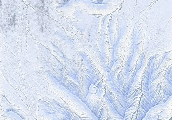 北海道オープンデータ「標高DEMラスタ 2023_令和5年_札幌建設管理部管内土砂洪水氾濫対策その4(稚内1地区)」(CC BY 4.0) を加工して作成/出典:国土地理院(標高タイル・シームレス空中写真を加工して作成)
Steepness · profile
← Distance 15.4 km →
Per-segment terrain (data table)
| % | m | Steepness | Aspect |
|---|---|---|---|
| 0% | 44 | 19° | N |
| 3% | 76 | 6° | NE |
| 6% | 109 | 10° | NE |
| 10% | 149 | 9° | N |
| 13% | 194 | 11° | N |
| 16% | 245 | 10° | W |
| 19% | 303 | 27° | W |
| 23% | 362 | 17° | NW |
| 26% | 433 | 16° | NW |
| 29% | 514 | 41° | NW |
| 32% | 621 | 40° | W |
| 35% | 822 | 41° | N |
| 39% | 1082 | 41° | NE |
| 42% | 1231 | 45° | E |
| 45% | 1259 | 52° | NE |
| 48% | 1410 | 46° | N |
| 52% | 1651 | 60° | NE |
| 55% | 1525 | 47° | N |
| 58% | 1323 | 52° | NW |
| 61% | 1235 | 50° | E |
| 65% | 1036 | 52° | W |
| 68% | 817 | 45° | NE |
| 71% | 681 | 56° | NW |
| 74% | 557 | 31° | N |
| 77% | 469 | 18° | NW |
| 81% | 391 | 27° | NW |
| 84% | 325 | 10° | NW |
| 87% | 265 | 11° | NW |
| 90% | 208 | 9° | N |
| 94% | 169 | 10° | NW |
| 97% | 122 | 6° | N |
| 100% | 88 | 19° | N |
Route guide
Rishiri-zan (1721 m, 'Rishiri-Fuji') is a lone volcano rising out of the Sea of Japan — the island west of Wakkanai IS the mountain. This is its most popular winter summit line, the North Ridge Classic: from the end of snow-clearing just past Rishiri-Fuji Onsen in Oshidomari, via the Hokuroku Campground, Chokan-zan (1218 m) and the Rishiri-zan Emergency Hut (a saddle at ~1232 m) to the northern summit (1719 m). Around 7.7 km one way, ~1594 m of cumulative climbing, ~7 hours (5 up, 2 down) — real ski mountaineering. Baked maximum slope ~49°; HokkaidoWilds grades it 9/10.
[When] In deep winter, calm days on Rishiri are 'almost unheard of' — January–February has the best snow but hopeless weather. March and April are the season for summit attempts: the weather is at its most stable and the gully snow is still excellent. Cloud is strongly aspect-dependent — the windward side can be socked in while the lee side sits under blue sky.
[The climb] The route is unmarked. From the road-end past the onsen, follow the road south to Hokuroku Campground, then head due south into the small valley; take the left-hand gully or the ridge as snow conditions dictate, joining the summer-trail ridge to Chokan-zan and on to the hut. The hut (open year-round; in big snow you may need to dig to the second-storey door) is the last shelter. Above the hut, crampons and an ice-axe are essential, and ski crampons make even the approach to the hut far more secure in all but the best conditions.
[Hut to summit] Not a technical roped climb, but not to be underestimated: the right (west) side of the narrow ridge drops all the way to the ocean, and the exposure overwhelms people who lack experience with this kind of ground. One party reported ~60 m of inward-facing downclimbing on crampons at around 1600 m; guided parties commonly carry ropes. Skis usually go back on around 1550 m. The GPX contains two diverging lines part-way up — with stable snow and buried vegetation, the western line down the wide watershed is the prize descent.
[Avalanche and self-sufficiency] There is NO avalanche bulletin for Rishiri. Your own observations are the only conditions data you get. The prevailing wind is northwest, so this N/NW route takes the brunt — the best snow actually hides on southerly and easterly aspects. Slopes run to the sea, the volcanic gullies are textbook terrain traps, and rescue resources are thinner than on the mainland. If weather, snowpack or energy fall short, turning around at Chokan-zan or the hut is the correct summit. 'Rishiri is a long way to go for bad weather' — build spare days into the plan. A description of the ground and the record, not a recommendation.
Access & logistics
[To the island] Heartland Ferry from Wakkanai to Oshidomari (Jan–Apr: two sailings daily, 6:55 and 13:55; ~¥2,500 each way; no extra charge for skis). Reach Wakkanai by highway bus or train from Sapporo/Asahikawa. The route start is ~1.5 km on foot from the ferry terminal.
[Start & parking] The end of snow-clearing just past Rishiri-Fuji Onsen; in April it may be possible to drive to Hokuroku Campground. Parking at the onsen.
[Base] The Rishiri Green Hill Inn in Oshidomari (winter by inquiry; the island's cheapest bed, with full views of the mountain) is the classic skiers' base. The Emergency Hut is for emergencies and shelter, not accommodation.
[No avalanche bulletin] Rishiri has no avalanche information service. Read JAN's education material and observations from elsewhere before the trip, then judge on the ground. Beacon/shovel/probe plus crampons, ice-axe and ski crampons are all required kit. File your plan via Compass.
[Weather] Windy.com's forecast proves accurate to the hour on Rishiri from ~2 days out; factor in the windward/lee cloud split.
[After] Rishiri-Fuji Onsen (¥500; winter hours noon–9pm, closed Mondays) sits at the very end of the route.
Today / tomorrow briefing
Loading…
Set reminders inside Google Calendar
Hokkaido Wilds · Rob Thomson — HokkaidoWilds.org · CC BY-SA 4.0
A planning aid, not a verdict. Always check the day’s official avalanche bulletin and decide in the field.
Route data source: Rob Thomson — HokkaidoWilds.org · CC BY-SA 4.0 · ↓ Download GPX