Shiribetsu-dake · Routes
↘ Shiribetsu-dake — West Bowl
This route carries serious backcountry hazards. Its slope and ATES labels are planning estimates; they do not decide whether it is safe today or suitable for your group.
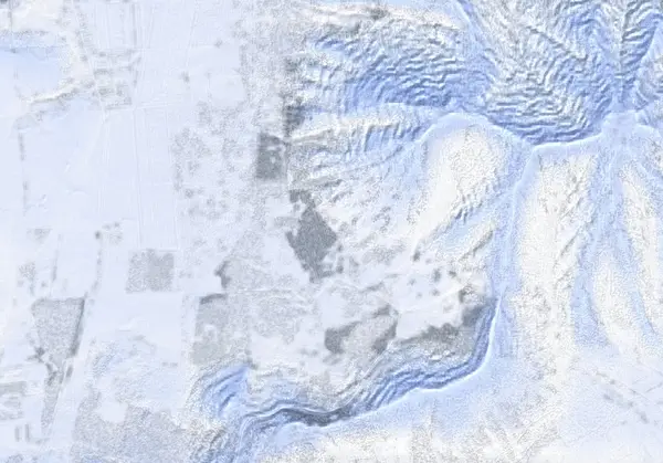 出典:国土地理院(標高タイル DEM10B を加工して作成)
Steepness · profile
← Distance 5.5 km →
Per-segment terrain (data table)
| % | m | Steepness | Aspect |
|---|---|---|---|
| 0% | 448 | 5° | NW |
| 3% | 458 | 5° | W |
| 6% | 472 | 7° | W |
| 10% | 487 | 7° | W |
| 13% | 500 | 8° | W |
| 16% | 518 | 9° | SW |
| 19% | 537 | 10° | W |
| 23% | 555 | 10° | SW |
| 26% | 577 | 10° | W |
| 29% | 599 | 13° | SW |
| 32% | 621 | 20° | SW |
| 35% | 657 | 31° | SW |
| 39% | 720 | 34° | S |
| 42% | 806 | 38° | S |
| 45% | 909 | 38° | S |
| 48% | 982 | 36° | E |
| 52% | 943 | 36° | SW |
| 55% | 891 | 41° | SW |
| 58% | 835 | 37° | SW |
| 61% | 784 | 39° | SW |
| 65% | 719 | 36° | SW |
| 68% | 667 | 21° | SW |
| 71% | 630 | 19° | S |
| 74% | 604 | 10° | W |
| 77% | 582 | 10° | W |
| 81% | 561 | 10° | SW |
| 84% | 539 | 9° | SW |
| 87% | 522 | 8° | W |
| 90% | 504 | 7° | W |
| 94% | 490 | 7° | NW |
| 97% | 475 | 5° | W |
| 100% | 461 | 4° | W |
Route guide
Shiribetsu-dake's West Bowl (尻別岳, 1107 m) climbs an isolated volcanic cone standing northeast of Rusutsu, taking its south-to-southwest flank (aspect SW, mean ~240 degrees). It is about 539 m of vertical over roughly 5.7 km round trip — an intermediate objective (HokkaidoWilds difficulty 5/10) rated ATES 'Challenging.' Read this as a description of the ground and the day's conditions, not a recommendation. The tour starts up a farm-road approach that crosses private agricultural land, so stay strictly on the route as you head in.
The lower mountain is a gentle climb through trees, gaining height by following the terrain. Note that the 41-degree maximum-slope figure reflects the steep bowl walls and short upper sections rather than the skinning line itself (the median grade is only around 9 degrees). Hidden within the easy angle are convex roll-overs that load up speed on the descent.
The mid-route landmark is the 'Well-spaced trees' at about 831 m. This is open, skiable glade — easy to read even on a poor-visibility day — and many parties use it as the start and finish of their descent. The forest gives shelter from wind, but the angle and wind effect both grow as you climb higher.
The heart of the route is the 'Avalanche path bowl' at roughly 873 m. This is a recognized slide path on the mountain and also the main descent line: ski it only in stable conditions. There is a terrain trap at the base of the bowl where sliding snow collects, and convex roll-overs above. Most people make this bowl and the glades below it their main run and do not necessarily push to the summit.
If you do continue to the summit (尻別岳, 1107 m; the marker reads about 1103 m on the track), the final ridge is an exposed W-to-SW spur. The prevailing northwest winds load the lee, building wind slab and cornices. Above treeline this is an open volcanic cone with little tree anchoring, so watch constantly for wind-loaded instabilities and cornice development along the ridge.
The single greatest descent hazard is dropping the wrong aspect. On an isolated cone like Shiribetsu-dake the upper slopes look near-identical in every direction, and in flat light — overcast or cloud that erases shadow and texture — it is easy to ski off onto an aspect other than the south-to-southwest West Bowl you ascended, a mistake made here every season. Descend while actively confirming your ascent aspect (SW) with GPS and compass. This is not a managed slope; the whole route is avalanche terrain and demands a current stability assessment and your own judgement. There is no dedicated daily bulletin for this peak, so use the Niseko-area avalanche product.
Access & logistics
Trailhead & parking: The West Bowl is approached from the south-to-southwest side of Shiribetsu-dake, the isolated cone northeast of Rusutsu. The approach is a farm road, and the usable parking and its exact spot depend on snow-clearing — check current local conditions before committing to a plan. The farm road crosses private agricultural land: park so you do not block traffic or plowing, and stay on the route.
Getting there: Access is typically by car from the Niseko / Kutchan / Rusutsu area. Expect snow and ice on the roads in winter — a 4WD vehicle with winter tyres or equivalent is appropriate. The farm road may be unplowed and the point you can drive to varies day to day. Public transport is sparse, so a private car or an arranged tour is the practical option.
Descent point: Most parties make the 'Avalanche path bowl' (~873 m) and the 'Well-spaced trees' glade below it (~831 m) their main descent line, and do not necessarily push to the summit (1107 m). Ski the bowl only in stable conditions; whether to continue to the summit ridge depends on the day's snow, visibility and your own judgement.
Avalanche info: There is no dedicated daily bulletin for this peak — use the Niseko-area avalanche product.
After: Onsen and food are scattered around the Niseko / Kutchan / Rusutsu area. Opening days and hours vary by season, so confirm locally.
Today / tomorrow briefing
Loading…
Set reminders inside Google Calendar
Hokkaido Wilds · Rob Thomson — HokkaidoWilds.org · CC BY-SA 4.0
A planning aid, not a verdict. Always check the day’s official avalanche bulletin and decide in the field.
Route data source: Rob Thomson — HokkaidoWilds.org · CC BY-SA 4.0