Mt Tokachidake · Routes
↘ Tokachidake — Maetokachi / Taisho Crater
This route carries serious backcountry hazards. Its slope and ATES labels are planning estimates; they do not decide whether it is safe today or suitable for your group.
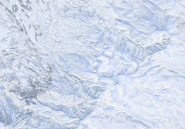 出典:国土地理院(標高タイル dem5a + DEM10B を加工して作成)
Steepness · profile
← Distance 6.4 km →
Per-segment terrain (data table)
| % | m | Steepness | Aspect |
|---|---|---|---|
| 0% | 1008 | 21° | W |
| 3% | 1018 | 18° | N |
| 6% | 1037 | 25° | NW |
| 10% | 1034 | 27° | NW |
| 13% | 1075 | 34° | N |
| 16% | 1089 | 28° | SW |
| 19% | 1124 | 34° | SW |
| 23% | 1168 | 32° | SW |
| 26% | 1196 | 15° | W |
| 29% | 1228 | 21° | W |
| 32% | 1272 | 21° | W |
| 35% | 1304 | 18° | NW |
| 39% | 1344 | 24° | NW |
| 42% | 1389 | 33° | NW |
| 45% | 1453 | 36° | NW |
| 48% | 1502 | 38° | NW |
| 52% | 1573 | 29° | N |
| 55% | 1605 | 33° | NW |
| 58% | 1523 | 35° | NW |
| 61% | 1439 | 31° | NW |
| 65% | 1373 | 19° | NW |
| 68% | 1328 | 18° | NW |
| 71% | 1282 | 21° | NW |
| 74% | 1247 | 19° | N |
| 77% | 1217 | 13° | SW |
| 81% | 1189 | 27° | W |
| 84% | 1148 | 28° | SW |
| 87% | 1117 | 27° | W |
| 90% | 1085 | 38° | SW |
| 94% | 1068 | 27° | NW |
| 97% | 1031 | 25° | N |
| 100% | 1034 | 21° | W |
Route guide
[Most important: this route's objective is currently CLOSED] Tokachidake is an active volcano. JMA raised it to Volcanic Alert Level 3 (mountain access restriction) at 09:30 JST on 12 September 2026 (in force as of 2026-09-12) and warns of large ballistic rocks within roughly 3 km of the crater. The Taisho crater, the 62-2 crater and the summit all lie inside that range. The Kamifurano-side trailheads (Tokachidake Onsen, Fukiage) are closed (Kamifurano Tokachidake Tourism Association, 12 September 2026). References below to a 'no-go ring' or '1.5 km' are June 2026 records and do not establish current access. This route's objective — the Taisho / 62-2 crater complex (~43.426N, 142.675E) — sits squarely inside that no-go ring. What follows is therefore a description of documented terrain that you MUST NOT ski until the alert eases — not an invitation to go. Before you even plan a start, re-check the live JMA volcano bulletin and the JAN Central Hokkaido avalanche bulletin.
The Maetokachi / Taisho Crater line runs from the Hakuginso / Fukiage Onsen side (~630 m, trailhead near 142.6416E, 43.4314N), past the Tokachidake Emergency Hut toward the Taisho crater and its fumarole ground — about 614 m of vertical over roughly 6.6 km, on a broadly northwest (NW) aspect. The lower mountain is forest and gentle snowfields; you gain height from the Hakuginso Lodge / Fukiage Onsen base. Read the ~42° maximum-slope figure as short steep sections up high, not the angle of the skinning line as a whole.
The defining hazard here is not just avalanches — it is the volcano itself. The nearer you get to the objective, the hotter the ground: near the vents and craters the ground exceeds 300°C. Hot ground melts thin snow from beneath, leaving steam voids — places that look like solid snow but are hollow underneath. Break through one and you risk burns and a fall, and you cannot tell them apart by eye. On top of that, volcanic gas (SO2 / H2S) is colourless and pools in low spots; in a windless basin or crater it can reach lethal concentration. These hazards remain even after the restriction is lifted.
The crux of the approach is crossing the "wide-open, featureless" snowfield. This part of Maetokachi has almost nothing to navigate by, and if visibility drops you can lose orientation completely. On these volcanic cones, flat light — gas or overcast that erases all shadow and surface texture — leads parties to drop onto an aspect other than the NW face they climbed and get funneled into a different drainage, a mistake made here every season. GPS is essential; back it up with a compass and confirm your descent bearing one leg at a time. On the way down, commit to the aspect you planned, and do not ski blind in a whiteout.
In short, this is a currently-closed objective you should not approach until the alert relaxes. The whole route is avalanche terrain that demands your own stability assessment and judgement, and it carries a second, separate family of lethal hazards unique to an active volcano: hot ground, hidden steam voids, and pooling volcanic gas. Everything shown here is a planning aid — not a recommendation and not a go/no-go decision. Always confirm the live JMA volcano bulletin and the latest JAN Central Hokkaido bulletin before any tour.
Access & logistics
[Restriction status — read first] Tokachidake is under JMA Volcanic Alert Level 3 / mountain access restriction (raised 12 September 2026; in force as of 2026-09-12). JMA warns of large ballistic rocks within roughly 3 km of the crater; this route's objective (the Taisho / 62-2 crater complex) lies inside that range, so it is CLOSED right now. The Kamifurano-side trailheads are closed. Before any start, confirm the current level and restriction radius on the live JMA volcano bulletin.
[Trailhead & parking] The start is on the Hakuginso / Fukiage Onsen side (~630 m, trailhead near 142.6416E, 43.4314N), with parking around the Hakuginso lodge. In winter, available parking depends on plowing, so check current local conditions.
[Getting there] Approach Hakuginso / Fukiage Onsen by car from the Kamifurano / Tokachidake Onsen side. Expect snow and ice on the roads — winter tyres (and 4WD if needed) are appropriate. Public transport is limited, so confirm options in advance.
[Volcanic gas & hot ground] Even on ground recorded outside the old ring, near the fumarole ground volcanic gas pools in basins and gullies and hot ground hollows out thin snow into steam voids — most dangerous in calm air or poor visibility.
[After] Bathing is available at Fukiage Onsen (Hakuginso and the Fukiage open-air pool), but hours and winter operation vary — confirm locally.
Today / tomorrow briefing
Loading…
Set reminders inside Google Calendar
Hokkaido Wilds · Rob Thomson — HokkaidoWilds.org · CC BY-SA 4.0
A planning aid, not a verdict. Always check the day’s official avalanche bulletin and decide in the field.
Route data source: Rob Thomson — HokkaidoWilds.org · CC BY-SA 4.0 · ↓ Download GPX