Backcountry areas · Tokachi Range, Daisetsuzan
Furano-dake
↕ 1013 m · 2 Routes · Explore in 3D
JMA raised the alert to Level 3 at 09:30 JST on 12 September 2026 and confirmed it remained in force at 16:00 JST on 14 September. Large ballistic rocks may affect roughly 3 km around the crater. Follow current local-government instructions for actual prohibited areas and road closures.
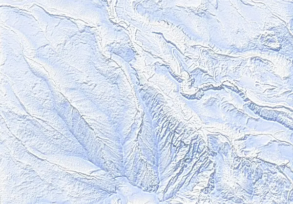 出典:国土地理院(標高タイル dem5a + DEM10B を加工して作成)
出典:国土地理院(標高タイル dem5a + DEM10B を加工して作成) / CC BY-SA 4.0
Mountain facts
5 fields without data yetEvery field shows its source and check date. A field without data says UNKNOWN; nothing is left blank or guessed.
- Name / area
-
富良野岳 · Furano-dake
Tokachi Range, Daisetsuzan
Source: SnowWind areas dataset - Elevation
-
1912 m (surveyed summit height)
1808 m (highest point in the terrain data, DEM10B) · ↕ 1013 m
Source: GSI (surveyed heights, DEM10B) · Checked 2026-09-23 - Municipalities
-
上富良野町 Kamifurano
Source: GSI reverse geocoder · Checked 2026-07-09 - Trailheads / parking
-
Parking for about 10 cars · 1012 m
Cleared parking · 1012 m
Source: Parking waypoints of the GPX routes (CC BY-SA) · Checked 2026-09-13 - Winter access
-
Winter road-closure status is published by Hokkaido’s road authorities. We link to the official source; we do not republish or cache it.
Source: Hokkaido road authorities / CERI (link only) - Route aspects
-
N · NE · W
Aspects the steep sections of recorded routes cross; not the whole mountain.
Source: Computed from DEM10B · Checked 2026-09-23 - Terrain class (estimate)
-
complex 2
Slope-based automatic estimate, not official ATES.
Source: SnowWind slope estimate · Checked 2026-09-23 - Recorded routes
-
2
Route data: CC BY-SA 4.0 (incl. Hokkaido Wilds, CC BY-SA)
Source: CC BY-SA 4.0 · Checked 2026-09-23 - Official avalanche bulletin
-
We link to bulletins and never republish their content.
JMA Volcano Bulletin — TokachidakeJapan Avalanche Network — Central Hokkaido (Daisetsu / Tokachi)
Source: JMA Volcano Bulletin — Tokachidake / Japan Avalanche Network — Central Hokkaido (Daisetsu / Tokachi) - Police station / where to file a 登山届
-
富良野警察署(Furano Police Station) · 0167-22-0110 · 上富良野町 Kamifurano
Station numbers are not emergency lines; in an emergency call 110.
富良野警察署(Furano Police Station)北海道警察 オンライン登山計画書Compass 登山届システムYAMAP(道警と閲覧協定)Draft a 登山届 from your plan
Source: 北海道警察 https://www.police.pref.hokkaido.lg.jp/intro/syozai/syozai.html · Checked 2026-07-31 · 登山届 2026-09-06 - Emergency huts
- UNKNOWN
No hut waypoint in the route data.
Source: GPX route waypoints - Volcano alerts
- UNKNOWN
No volcano alert data registered here for this mountain; JMA is the authority.
Source: JMA (link only) - Nearest AMeDAS station
-
富良野(Furano)· 174 m · 20.1 km
Source: JMA AMeDAS station table · Checked 2026-09-02 - Live camera
- UNKNOWN
No live-camera source compiled for this mountain yet.
Source: To be added - Snow season
- UNKNOWN
Not compiled yet. Planned from AMeDAS snow-depth history.
Source: To be added - Nearby resorts
-
Furano · 25 km · Asahidake · 31 km · Hoshino Tomamu · 38 km
Source: Straight-line distance between SnowWind 3D dataset centres - Guide services
- UNKNOWN
Real guide listings are in preparation; the directory is a fictional sample for now.
Source: SnowWind
Today / tomorrow briefing
Loading…
Set reminders inside Google Calendar
Routes in this area: Furano-dake — Nishi-shamen · Furano-dake — Giant Ridge
A planning aid, not a verdict. Always check the day’s official avalanche bulletin and decide in the field.
Today's conditions
Safety
Routes
Access & terrain features
Route GPX waypoints and elevations are planning data. Verify them against current official information and in the field.