Furano-dake · Routes
↘ Furano-dake — Giant Ridge
This route carries serious backcountry hazards. Its slope and ATES labels are planning estimates; they do not decide whether it is safe today or suitable for your group.
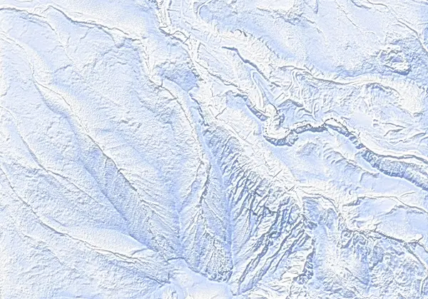 出典:国土地理院(標高タイル dem5a + DEM10B を加工して作成)
Steepness · profile
← Distance 4.2 km →
Per-segment terrain (data table)
| % | m | Steepness | Aspect |
|---|---|---|---|
| 0% | 1016 | 31° | NW |
| 3% | 1004 | 35° | NW |
| 6% | 991 | 34° | W |
| 10% | 1012 | 22° | NE |
| 13% | 1022 | 28° | N |
| 16% | 1053 | 34° | N |
| 19% | 1072 | 37° | N |
| 23% | 1092 | 39° | SW |
| 26% | 1104 | 37° | SW |
| 29% | 1123 | 35° | N |
| 32% | 1183 | 35° | NE |
| 35% | 1229 | 28° | N |
| 39% | 1273 | 26° | N |
| 42% | 1322 | 29° | N |
| 45% | 1374 | 33° | NE |
| 48% | 1420 | 35° | NE |
| 52% | 1476 | 35° | NE |
| 55% | 1518 | 35° | NE |
| 58% | 1478 | 35° | NE |
| 61% | 1425 | 32° | NE |
| 65% | 1375 | 28° | N |
| 68% | 1320 | 28° | N |
| 71% | 1269 | 29° | N |
| 74% | 1224 | 34° | N |
| 77% | 1174 | 33° | NE |
| 81% | 1113 | 38° | E |
| 84% | 1102 | 39° | W |
| 87% | 1092 | 36° | SW |
| 90% | 1065 | 32° | N |
| 94% | 1041 | 24° | N |
| 97% | 1012 | 33° | NE |
| 100% | 991 | 35° | N |
Route guide
[CLOSED RIGHT NOW] JMA raised Tokachidake to Volcanic Alert Level 3 (mountain access restriction) on 12 September 2026 (in force as of 2026-09-12; large ballistic rocks possible within roughly 3 km of the crater). On the Kamifurano side the Tokachidake Onsen and Fukiage trailheads are closed and climbing toward the Daisetsuzan range from the town is prohibited, so this route on the same active volcanic group is closed right now (Kamifurano Tokachidake Tourism Association, 12 September 2026).
Furano-dake (1912 m) anchors the southwest end of the Tokachi Range, but the winter ski objective is not the summit — it is the broad Giant Ridge running northwest from it. From the winter trailhead (~1000 m) to about 1500 m on the ridge is roughly 520 m of vertical over a ~4.5 km, ~4.5 hour half-day, graded 6.5/10 by Hokkaido Wilds. The 1912 m summit itself is a serious winter-mountaineering objective and is not part of this route. Treat the day as including ATES Complex (Level 3) terrain.
[The climb] From the trailhead beside the Okinakouen bus stop the line gains the forested ridge. The lower ridge is sheltered and pleasant; above treeline the surface turns wind-hammered, powder generally runs out around 1400 m, and the top of the skin line sits in crust (the ~1515 m 'climb till crusty' waypoint).
[The skiing] The character of this route is skiing the broad ridge crest itself back down — the comparatively conservative option on days when avalanche conditions are elevated. Comparatively: the baked 80° maximum is a local off-ridge valley-wall value (median ~30°), and the valley immediately north of the Giant Ridge is unambiguous avalanche terrain. The moment you drop off the crest to the north, the terrain changes category. An 'avalanche risk' waypoint is marked at ~1256 m.
[Cautions] The old 'outside the zone' wording is a Level 2 record (June 2026 to 11 September 2026) and does not establish current access. Check the live JMA volcano bulletin, town notices and the JAN Central Hokkaido avalanche bulletin before touring.
Access & logistics
Trailhead & parking: The same winter trailhead as the Nishi-shamen route (~1000 m, Hakuginso turnoff / Okinakouen bus stop). The lot fits 6–7 cars and fills fast — arrive early or use the Fukiage Onsen carpark 1.5 km down-road. Roadside parking is illegal.
Getting there: By car from Kami-Furano, or the town bus from JR Kami-Furano Station (~30 min, ~¥500, 3/day).
The day: A ~4.5 hour half-day. The trailhead area itself is wind-exposed on stormy days.
Onsen: the free Fukiage wild rotenburo, Ryounkaku, Hakuginso — confirm hours locally.
Info: Check the live JMA volcano bulletin and the JAN Central Hokkaido bulletin before every tour.
Today / tomorrow briefing
Loading…
Set reminders inside Google Calendar
Hokkaido Wilds · Rob Thomson — HokkaidoWilds.org · CC BY-SA 4.0
A planning aid, not a verdict. Always check the day’s official avalanche bulletin and decide in the field.
Route data source: Rob Thomson — HokkaidoWilds.org · CC BY-SA 4.0 · ↓ Download GPX