Iwaonupuri · Routes
↘ Iwaonupuri — NE Chute
This route carries serious backcountry hazards. Its slope and ATES labels are planning estimates; they do not decide whether it is safe today or suitable for your group.
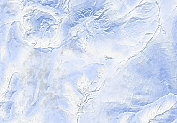 出典:国土地理院(標高タイル DEM10B を加工して作成)
Steepness · profile
← Distance 5.0 km →
Per-segment terrain (data table)
| % | m | Steepness | Aspect |
|---|---|---|---|
| 0% | 761 | 17° | SW |
| 3% | 779 | 17° | W |
| 6% | 787 | 14° | W |
| 9% | 801 | 12° | E |
| 13% | 808 | 38° | S |
| 16% | 853 | 20° | E |
| 19% | 878 | 38° | SE |
| 22% | 951 | 41° | S |
| 25% | 1057 | 39° | SE |
| 28% | 1086 | 37° | SE |
| 31% | 1050 | 45° | NE |
| 34% | 1003 | 46° | E |
| 38% | 918 | 40° | NE |
| 41% | 868 | 40° | NE |
| 44% | 843 | 38° | NE |
| 47% | 825 | 33° | N |
| 50% | 829 | 46° | NE |
| 53% | 917 | 58° | NE |
| 56% | 1029 | 54° | E |
| 59% | 1104 | 28° | NW |
| 63% | 1097 | 36° | S |
| 66% | 1056 | 44° | E |
| 69% | 1007 | 46° | NE |
| 72% | 920 | 40° | NE |
| 75% | 887 | 27° | E |
| 78% | 856 | 31° | SE |
| 81% | 844 | 36° | SE |
| 84% | 819 | 36° | S |
| 88% | 812 | 24° | E |
| 91% | 807 | 9° | SE |
| 94% | 801 | 13° | S |
| 97% | 795 | 17° | SW |
| 100% | 782 | 17° | SW |
Route guide
Iwaonupuri's NE Chute is one of the steepest committed lines in the Niseko Range — a 35–40° chute dropping about 200 m of its ~550 m total, over a 5.1 km, ~6 hour day graded 7.5/10 by Hokkaido Wilds. The baked 53° maximum is a local chute-wall value, not the ski line itself (median ~28°), but this is unambiguous ATES Complex (Level 3) avalanche terrain. Read this as a description of the ground, not a recommendation.
[The climb] From the plowed carpark at the end of Route 58 beyond Goshiki Onsen (~760 m), the route gains the summit plateau. The source strongly recommends ascending the same northeastern face you intend to ski — the skin up is your snowpack inspection. A waypoint on the eastern spur (~920 m) marks 'recommended to check snowpack (same aspect as chute)'.
[The chute — the crux] The entrance sits about 50 m north of the summit plateau. The top is a prominent convex roll: what lies below is not visible until you are well over it. The first third is committing, with very little escape to the sides; below that the chute widens considerably to skier's left, with bushy shrubs to skier's right. Minor wind slab has been observed at the very top. Snowpack stability is everything on this line.
[Cautions] The northeastern side of the mountain is seldom travelled and relatively remote — be fully self-sufficient. Iwaonupuri is an active volcano of the JMA-listed Niseko group (no alert level currently operated); the crater area west of the summit is sulphur/geothermal ground. Check the Niseko avalanche bulletin and the Japan Avalanche Network SW Hokkaido bulletin before every tour.
Access & logistics
Start & parking: The large plowed area at the end of snow-clearing on Route 58, just beyond Goshiki Onsen (~760 m). Can fill by ~9 am on weekends — start early.
Getting there: ~23 km from central Hirafu. No public transport; a taxi runs ¥7,500–8,000 one-way. Expect packed snow and ice on the roads.
Onsen: Goshiki Onsen (10:00–19:00, ¥800) is right by the carpark; Yukichichibu (12:00–19:00, ¥700, closed Tue) is nearby. Hours vary — confirm locally.
Avalanche info: Check the Niseko Avalanche Institute bulletin and the Japan Avalanche Network SW Hokkaido bulletin before departing.
Today / tomorrow briefing
Loading…
Set reminders inside Google Calendar
Hokkaido Wilds · Rob Thomson — HokkaidoWilds.org · CC BY-SA 4.0
A planning aid, not a verdict. Always check the day’s official avalanche bulletin and decide in the field.
Route data source: Rob Thomson — HokkaidoWilds.org · CC BY-SA 4.0 · ↓ Download GPX