Iwaonupuri · Routes
↘ Iwaonupuri — Goshiki Onsen Route
This route carries serious backcountry hazards. Its slope and ATES labels are planning estimates; they do not decide whether it is safe today or suitable for your group.
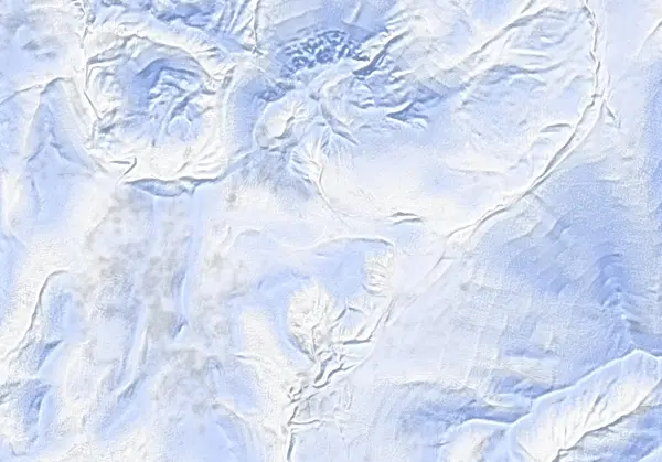 出典:国土地理院(標高タイル DEM10B を加工して作成)
Steepness · profile
← Distance 3.5 km →
Per-segment terrain (data table)
| % | m | Steepness | Aspect |
|---|---|---|---|
| 0% | 767 | 10° | NW |
| 3% | 779 | 17° | SW |
| 6% | 786 | 13° | W |
| 10% | 798 | 12° | SW |
| 13% | 800 | 6° | NE |
| 16% | 801 | 19° | SE |
| 19% | 812 | 21° | SE |
| 23% | 839 | 15° | SE |
| 26% | 854 | 14° | SE |
| 29% | 872 | 15° | E |
| 32% | 891 | 21° | SE |
| 35% | 915 | 36° | S |
| 39% | 967 | 40° | S |
| 42% | 1026 | 41° | S |
| 45% | 1063 | 25° | W |
| 48% | 1071 | 30° | W |
| 52% | 1093 | 23° | SW |
| 55% | 1100 | 23° | E |
| 58% | 1091 | 41° | S |
| 61% | 1097 | 45° | S |
| 65% | 1018 | 43° | S |
| 68% | 964 | 32° | S |
| 71% | 920 | 25° | SE |
| 74% | 885 | 20° | SE |
| 77% | 864 | 15° | E |
| 81% | 847 | 21° | SE |
| 84% | 830 | 22° | SE |
| 87% | 806 | 8° | SE |
| 90% | 800 | 4° | SE |
| 94% | 800 | 13° | E |
| 97% | 794 | 13° | SW |
| 100% | 785 | 17° | W |
Route guide
Iwaonupuri (1116 m) — 'sulphur mountain' in Ainu — is the youngest volcano of the Niseko group, and this route is the accessible half-day on its south side from Goshiki Onsen: about 3.5 km, 320 m of climbing, 3 hours total (1.5 up, 1 down), graded 5/10 by Hokkaido Wilds. It is the quickest escape from the resort crowds — but short does not mean free of avalanche terrain. Read this as a description of the ground.
[The climb] From the end of snow-clearing on Route 58 (~760 m) the route runs flat for several hundred metres, then gains the northwestern ridge. The lower ~150 m of the ridge is a labyrinth of thin trees; above that it opens up. The upper ridge is heavily wind-swept and often icy — the source advises taking 'a wide berth westwards from around the 900 m altitude mark towards the summer track if the going is too icy.'
[Terrain and avalanches] The large southeast bowl and the eastern ridge are prone to avalanches in unstable conditions (the GPX marks an avalanche-risk waypoint near 1090 m). The standard descent retraces the southerly ascent line; whether to ski the bowl is a decision for the day's stability assessment, made by you.
[This is a volcano] West of the summit lies a crater complex about 350×250 m across with a nested ~100 m inner crater — sulphur-crystal, geothermally altered ground with fumarole activity recorded from the late Edo period into the early 1900s. No volcanic alert level is currently operated and there is no access restriction, but thin snow over geothermal ground can hide voids. Check the JMA volcano information and the Niseko avalanche bulletin before you go.
Access & logistics
Start & parking: The plowed space at the end of Route 58 just above Goshiki Onsen (~760 m); 30–40 minutes by car from Hirafu. No winter public transport.
The day: ~3.5 km and ~3 hours — a half-day tour. Best season January–April.
Onsen: Goshiki Onsen is a few minutes' walk from the carpark (10:00–19:00, ¥800); Yukichichibu (¥700, closed Tue) is nearby. Confirm hours locally.
Info: Check the JMA volcano information (Niseko), the Niseko avalanche bulletin and the JAN SW Hokkaido bulletin before departing.
Today / tomorrow briefing
Loading…
Set reminders inside Google Calendar
Hokkaido Wilds · Rob Thomson — HokkaidoWilds.org · CC BY-SA 4.0
A planning aid, not a verdict. Always check the day’s official avalanche bulletin and decide in the field.
Route data source: Rob Thomson — HokkaidoWilds.org · CC BY-SA 4.0 · ↓ Download GPX