Kuro-dake · Routes
↘ Kuro-dake — Sounkyo Ropeway route
This route carries serious backcountry hazards. Its slope and ATES labels are planning estimates; they do not decide whether it is safe today or suitable for your group.
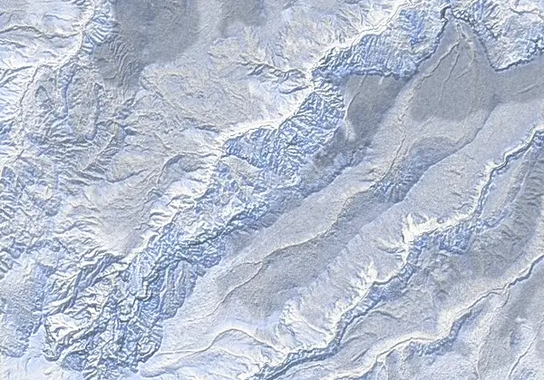 出典:国土地理院(標高タイル dem5a + DEM10B を加工して作成)
Steepness · profile
← Distance 6.5 km →
Per-segment terrain (data table)
| % | m | Steepness | Aspect |
|---|---|---|---|
| 0% | 1301 | 27° | E |
| 3% | 1309 | 21° | SE |
| 6% | 1328 | 25° | NE |
| 10% | 1363 | 34° | E |
| 13% | 1409 | 22° | E |
| 16% | 1427 | 29° | NE |
| 19% | 1476 | 30° | NE |
| 23% | 1545 | 32° | E |
| 26% | 1641 | 34° | NE |
| 29% | 1750 | 43° | E |
| 32% | 1814 | 40° | E |
| 35% | 1897 | 41° | E |
| 39% | 1972 | 41° | E |
| 42% | 1854 | 40° | E |
| 45% | 1791 | 43° | E |
| 48% | 1707 | 34° | NE |
| 52% | 1595 | 32° | NE |
| 55% | 1516 | 29° | NE |
| 58% | 1447 | 22° | E |
| 61% | 1417 | 34° | SE |
| 65% | 1391 | 26° | NE |
| 68% | 1348 | 25° | NE |
| 71% | 1318 | 21° | NE |
| 74% | 1307 | 48° | SE |
| 77% | 1262 | 43° | NE |
| 81% | 1133 | 31° | NW |
| 84% | 1046 | 29° | N |
| 87% | 997 | 59° | N |
| 90% | 905 | 48° | N |
| 94% | 759 | 44° | N |
| 97% | 704 | 50° | NW |
| 100% | 694 | 40° | N |
Route guide
Kuro-dake (1984 m) is the rock bastion at the northern end of the Daisetsuzan Range, and one of Hokkaido's finest pieces of lift-accessed alpine: the Sounkyo Ropeway lifts you to ~1300 m, near treeline. Don't let the ropeway lull you — everything above the upper chairlift (which runs only in the spring-skiing months) is uncontrolled, unpatrolled backcountry, with midwinter temperatures happily below −20°C plus wind. The peak is flanked by deep, cliff-lined gorges (the Kurodakesawa drainage above all), so staying on line is not optional. With the lift assist the day is ~700 m of height (cumulative ~640 m) over a ~6.6 km, ~4.5 hour round trip; baked maximum slope ~57° (short walls toward the gorge), median ~30°.
[The climb] Sign the backcountry logbook at the top ropeway station before setting out — it is the reference for any search-and-rescue. The leg to the upper chairlift station (~1500 m, closed until spring) is gentle; above it the face steepens sharply into long zig-zags. Keeping toward the northeastern ridge, snow is usually decent to ~1750 m; above that hard windpack is the norm and ski crampons — sometimes a bootpack with crampons — are needed. The summit is windswept, bare rock.
[The descent and the return traverse — the crux of this route] The standard descent is back the way you came. If the snowpack allows, the main east-northeast face gives great skiing — but the one thing you MUST hold is the traverse line cutting back north to the upper chairlift station. Ski the fall line past that cut-back and the main face funnels you toward the cliff bands of the Kurodakesawa side. The cliffs marked on the government topo are only the major ones — there are unmarked ones too — and it is not uncommon for experienced and inexperienced parties alike to get bluffed, with no option but a steep bootpack back up through bottomless powder. Identify the traverse entry while you still have visibility, and if in doubt climb back to the ascent ridge. The last ropeway down is part of the plan — and the ropeway stops in high wind.
[Skiing below the top station] A descent from the gondola top station to Sounkyo Village is also recorded (included in this track, down to ~660 m), but it is a route-finding exercise: tight steep trees up top, tight-ish trees mid-way, then a steep lower section prone to breakable crust, with flat spots and bluff traps mixed in — a narrow gap between cliff bands is waypointed at ~43.7173N, 142.9437E. Most parties simply ride the ropeway down.
[Avalanche and weather] The main face aspects northeast and loads as a lee slope under the prevailing northwest winter winds. Check the JAN Central Hokkaido bulletin (3x weekly), treat the day as ATES-Complex terrain, and make your own stability assessment. Weather windows are short; gas and ground blizzard erase visibility fast. A description of the ground, not a recommendation.
Access & logistics
[Start] The Sounkyo Ropeway (runs year-round; closes in high wind). ¥2,400 round trip / ¥1,400 one-way. Catch the first car up — expect queues in season — and sign the climbers' logbook at the top station. The upper chairlift runs only from April (spring skiing).
[Getting there] Sounkyo is ~65 km east of Asahikawa; the expressway to the Kamikawa-Sounkyo IC speeds it up. Large carpark on the western side of the gondola building; winter public buses serve Sounkyo (bus terminal is a 5-minute walk from the gondola station).
[Planning] Build the day backward from the last ropeway down, and have a plan for a wind closure (the on-skis descent to the village is an advanced route-finding exercise). File your plan with the police via the Compass online system.
[Snow info] JAN Central Hokkaido bulletins (3x weekly) plus a forecast such as windy.com. Below −20°C is normal in deep winter, with windchill on top.
[After] Kurodake-no-yu onsen (¥600) is a couple of minutes' stroll from the gondola station; Sounkyo village has lodging and restaurants.
Today / tomorrow briefing
Loading…
Set reminders inside Google Calendar
Hokkaido Wilds · Rob Thomson — HokkaidoWilds.org · CC BY-SA 4.0
A planning aid, not a verdict. Always check the day’s official avalanche bulletin and decide in the field.
Route data source: Rob Thomson — HokkaidoWilds.org · CC BY-SA 4.0 · ↓ Download GPX