Muine-yama · Routes
↘ Muine-yama — Usubetsu Route
This route carries serious backcountry hazards. Its slope and ATES labels are planning estimates; they do not decide whether it is safe today or suitable for your group.
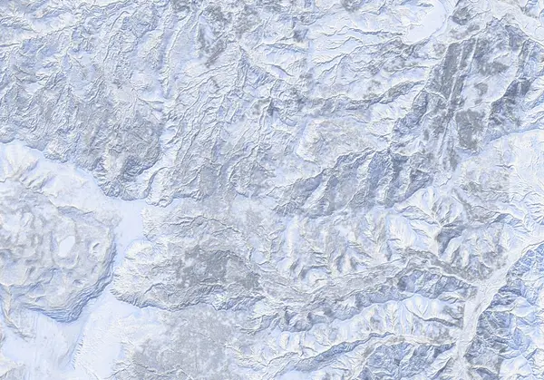 出典:国土地理院(標高タイル dem5a + DEM10B を加工して作成)
Steepness · profile
← Distance 15.5 km →
Per-segment terrain (data table)
| % | m | Steepness | Aspect |
|---|---|---|---|
| 0% | 598 | 45° | NE |
| 3% | 579 | 39° | N |
| 6% | 614 | 38° | N |
| 10% | 662 | 33° | NE |
| 13% | 739 | 22° | NW |
| 16% | 820 | 35° | SW |
| 19% | 883 | 35° | NE |
| 23% | 1002 | 39° | N |
| 26% | 1121 | 30° | N |
| 29% | 1141 | 18° | SW |
| 32% | 1145 | 20° | SW |
| 35% | 1186 | 11° | NW |
| 39% | 1240 | 45° | N |
| 42% | 1273 | 40° | NW |
| 45% | 1351 | 26° | E |
| 48% | 1437 | 43° | NE |
| 52% | 1443 | 42° | E |
| 55% | 1443 | 40° | E |
| 58% | 1367 | 43° | E |
| 61% | 1298 | 45° | N |
| 65% | 1250 | 14° | N |
| 68% | 1195 | 20° | NW |
| 71% | 1144 | 18° | SW |
| 74% | 1137 | 30° | SW |
| 77% | 1137 | 39° | W |
| 81% | 1019 | 35° | NW |
| 84% | 893 | 35° | NW |
| 87% | 821 | 22° | NW |
| 90% | 751 | 33° | NW |
| 94% | 675 | 35° | NE |
| 97% | 618 | 38° | E |
| 100% | 583 | 45° | W |
Route guide
The Usubetsu route on Muine-yama is the long classic from the Jozankei side: about 19 km round trip, 1068 m of climbing and around 7 hours via a logging road and the summer-trail corridor to the 1464 m summit, graded 8/10 by Hokkaido Wilds. Beyond the long gentle approach waits the north-and-east-face terrain of the mountain with the most avalanche fatalities in the Sapporo region. Read this as a description, not a recommendation.
[Important — the hut is gone] The traditional waystation of this route, the Hokkaido University-owned Muine-jiri hut (built 1931), burned to the ground on the night of 2 November 2024 (all 23 occupants walked out; no injuries). There is no usable hut on this route any more. Plan it as a day trip, with conservative margins of time and retreat.
[The climb] From the parking at the Usubetsu forestry-road entrance, ~5 km of road leads to the summer-trail junction near 800 m. A flat called 'the Terrace' (~1200 m) is the doorway to the upper plateau and the ridge. The hut site (~1020 m) is now a cleared ruin.
[The skiing and the avalanches] The north-facing lee slopes load deep and are high-risk avalanche terrain — the source explicitly calls for 'very conservative decisions when choosing slopes.' The baked 89° maximum is a local valley-wall artifact (median ~21°), but the east- and north-side gully runouts are precisely the terrain of the accident record. Check the Japan Avalanche Network SW Hokkaido bulletin before departing and make your own stability assessment.
Access & logistics
Start & parking: A large cleared parking space at the Usubetsu forestry-road entrance, a few kilometres from Jozankei toward Nakayama Pass.
Getting there: A car is the practical option. By public transport, the free shuttle from Makomanai subway station to Hana-no-Yu in Jozankei (earliest 9:30) plus a ~¥2,000 taxi is known — but you must make the ~16:15 return bus.
The day: ~19 km and ~7 hours. The Muine-jiri hut burned down in November 2024 — there is no shelter on the mountain. December–March is best.
Onsen: Hoheikyo Onsen (¥1000), Hotel Milione (¥500), Matsu-no-yu (~¥650). Confirm hours locally.
Info: Check the Japan Avalanche Network SW Hokkaido bulletin before departing.
Today / tomorrow briefing
Loading…
Set reminders inside Google Calendar
Hokkaido Wilds · Rob Thomson — HokkaidoWilds.org · CC BY-SA 4.0
A planning aid, not a verdict. Always check the day’s official avalanche bulletin and decide in the field.
Route data source: Rob Thomson — HokkaidoWilds.org · CC BY-SA 4.0 · ↓ Download GPX