Mt Tokachidake · Routes
↘ Tokachidake — Maetokachi Kabawara Ridge
This route carries serious backcountry hazards. Its slope and ATES labels are planning estimates; they do not decide whether it is safe today or suitable for your group.
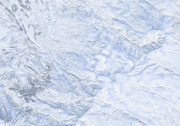 出典:国土地理院(標高タイル dem5a + DEM10B を加工して作成)
Steepness · profile
← Distance 6.0 km →
Per-segment terrain (data table)
| % | m | Steepness | Aspect |
|---|---|---|---|
| 0% | 1016 | 25° | N |
| 3% | 1024 | 12° | W |
| 6% | 1037 | 25° | NW |
| 10% | 1036 | 27° | NW |
| 13% | 1075 | 38° | N |
| 16% | 1086 | 27° | W |
| 19% | 1107 | 20° | NW |
| 23% | 1133 | 28° | NE |
| 26% | 1170 | 21° | W |
| 29% | 1217 | 35° | NW |
| 32% | 1276 | 32° | N |
| 35% | 1341 | 32° | NW |
| 39% | 1413 | 33° | N |
| 42% | 1490 | 37° | NW |
| 45% | 1547 | 33° | W |
| 48% | 1619 | 30° | W |
| 52% | 1699 | 31° | NW |
| 55% | 1685 | 30° | W |
| 58% | 1599 | 36° | NW |
| 61% | 1508 | 36° | W |
| 65% | 1437 | 42° | W |
| 68% | 1358 | 44° | W |
| 71% | 1285 | 44° | SW |
| 74% | 1240 | 41° | W |
| 77% | 1197 | 32° | W |
| 81% | 1163 | 21° | W |
| 84% | 1134 | 27° | N |
| 87% | 1110 | 27° | SW |
| 90% | 1083 | 38° | W |
| 94% | 1068 | 27° | NW |
| 97% | 1031 | 25° | W |
| 100% | 1036 | 17° | NW |
Route guide
[READ FIRST — the upper route is currently CLOSED inside the restriction] Tokachidake is an active volcano. JMA raised it to Volcanic Alert Level 3 (mountain access restriction) at 09:30 JST on 12 September 2026 (in force as of 2026-09-12) and warns of large ballistic rocks within roughly 3 km of the crater. The top of the Kabawara Ridge line — its endpoint at the Maetokachi fumarole field (~43.4232N, 142.6714E, only ~300 m from the 62-2 crater) — lies deep inside that range. The Kamifurano-side trailheads (Tokachidake Onsen, Fukiage) are closed (Kamifurano Tokachidake Tourism Association, 12 September 2026). Climbing toward the Daisetsuzan range from Kamifurano town is prohibited outright, so this line is closed in full. References below to a 'no-go ring', '1.5 km' or '~1500 m' are records from the Level 2 period (June 2026 to 11 September 2026) and do not establish current access. The line shown here is the pre-restriction recorded track (CC BY-SA 4.0, HokkaidoWilds.org) displayed faithfully; the live JMA restriction ALWAYS overrides a historical route line. Do not enter the restricted zone. What follows is a record of the terrain until the alert eases.
[Route overview] Maetokachi's (1790 m) broad, plank-like northwest face is a classic Tokachi backcountry playground of wide gullies and snowfields, and Kabawara Ridge is its most-travelled ascent line. From Hakuginso (~1010–1020 m) it climbed through the scorched stumps of a burnt forest for about 770 m of vertical over a ~6 km, ~4 hour round trip. Baked maximum slope is ~47° (a short steep section), median ~25°.
[Character] The ridge itself was regarded as the safest-of-the-lot line, with the prime skiing in the wind-sheltered gullies to skier's right (a 'sheltered gully' waypoint sits at ~1660 m). The top ~150 m, however, is heavily wind-scoured — scrub pine and boulders emerge — and needs the deep, consolidated cover more typical of March. The gullies are also textbook terrain traps: debris piles deep in them.
[The ridge does NOT connect to the summit] Topo contours appear to show an easy connecting ridge from Maetokachi to the Tokachidake summit, but the rim of the adjacent Taisho crater is unstable, crumbling ground under a massive volcanic plume, and that traverse was judged unsafe and unwise long before the current restriction. Summit parties historically went the long way round via the Emergency Hut (see the Maetokachi / Taisho Crater page) — and today all of it lies inside the no-go ring.
[Volcano-specific hazards] The fumarole field at the line's end is ground of strong volcanic gas (SO2/H2S) and geothermal heat; thin snow hides voids over hot ground, and the colourless gas pools in hollows to potentially lethal concentrations on calm days. These hazards persist even after any future easing of the alert.
[Navigation] The NW face is wide and featureless; in flat light even ridge and gully blur together. Confirm your position leg by leg with GPS and compass and keep away from the crater side (the '1.5 km from the 62-2 crater' boundary is a Level 2 record, June 2026 to 11 September 2026). Check both the live JMA volcano bulletin and the JAN Central Hokkaido avalanche bulletin before any tour. This is a record, not a recommendation.
Access & logistics
[Restriction — read first] Tokachidake is at JMA Volcanic Alert Level 3 (mountain access restriction, raised 12 September 2026; in force as of 2026-09-12). JMA warns of large ballistic rocks within roughly 3 km of the crater; this line is CLOSED in full — the Kamifurano-side trailheads cannot be used and climbing toward the Daisetsuzan range from the town is prohibited (Kamifurano Tokachidake Tourism Association, 12 September 2026). 'Above roughly 1500 m' is a Level 2 record (June 2026 to 11 September 2026). The live JMA restriction always overrides the historical route line — confirm the current level and extent on the JMA volcano bulletin before any plan.
[Start & parking] Hakuginso lodge (Fukiage Onsen, ~1020 m); backcountry users park on the eastern side (¥500 overnight). Bunks ~¥3100 (¥3250 in winter), communal kitchen, drying room, onsen.
[Getting there] Winter access via Route 291 from Kami-Furano only (the Biei/Shirogane road closes in winter); ~3 h drive from Sapporo, or town bus from JR Kami-Furano Station.
[Snow info] Pair the JMA bulletin with the JAN Central Hokkaido avalanche bulletin (3x weekly). The top 150 m is wind-scoured with emerging scrub and boulders — historically a March-and-later objective for coverage.
[After] Day-use bath at Hakuginso; the free Fukiage rotenburo is 10 minutes down the road.
Today / tomorrow briefing
Loading…
Set reminders inside Google Calendar
Hokkaido Wilds · Rob Thomson — HokkaidoWilds.org · CC BY-SA 4.0
A planning aid, not a verdict. Always check the day’s official avalanche bulletin and decide in the field.
Route data source: Rob Thomson — HokkaidoWilds.org · CC BY-SA 4.0 · ↓ Download GPX