Mt Tokachidake · Routes
↘ Tokachidake — Sandan-yama
This route carries serious backcountry hazards. Its slope and ATES labels are planning estimates; they do not decide whether it is safe today or suitable for your group.
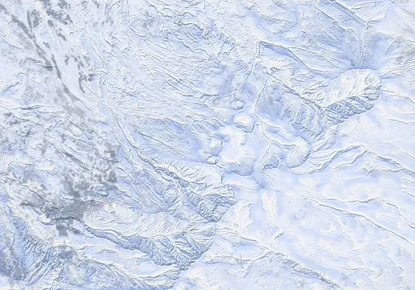 出典:国土地理院(標高タイル dem5a + DEM10B を加工して作成)
Steepness · profile
← Distance 5.9 km →
Per-segment terrain (data table)
| % | m | Steepness | Aspect |
|---|---|---|---|
| 0% | 1014 | 25° | NW |
| 3% | 1039 | 16° | NW |
| 6% | 1069 | 20° | NW |
| 10% | 1097 | 26° | N |
| 13% | 1135 | 29° | W |
| 16% | 1180 | 28° | N |
| 19% | 1212 | 26° | NW |
| 23% | 1249 | 31° | N |
| 26% | 1303 | 31° | NW |
| 29% | 1350 | 22° | W |
| 32% | 1391 | 37° | N |
| 35% | 1441 | 40° | NE |
| 39% | 1510 | 23° | NW |
| 42% | 1563 | 31° | N |
| 45% | 1609 | 36° | SW |
| 48% | 1676 | 40° | NW |
| 52% | 1735 | 41° | SW |
| 55% | 1706 | 35° | NW |
| 58% | 1636 | 36° | NE |
| 61% | 1589 | 26° | N |
| 65% | 1534 | 34° | N |
| 68% | 1457 | 40° | NW |
| 71% | 1410 | 27° | N |
| 74% | 1359 | 30° | NW |
| 77% | 1315 | 31° | SW |
| 81% | 1262 | 31° | N |
| 84% | 1220 | 23° | NW |
| 87% | 1196 | 28° | NW |
| 90% | 1154 | 29° | NE |
| 94% | 1108 | 23° | W |
| 97% | 1075 | 16° | NW |
| 100% | 1048 | 15° | NW |
Route guide
[Read first — active volcano, Alert Level 3] Tokachidake is an active volcano. JMA raised it to Volcanic Alert Level 3 (mountain access restriction) at 09:30 JST on 12 September 2026 (in force as of 2026-09-12) and warns of large ballistic rocks within roughly 3 km of the crater. (Confirmed again on 14 September.) On the Kamifurano side the Tokachidake Onsen and Fukiage trailheads are closed and climbing toward the Daisetsuzan range from the town is prohibited (Kamifurano Tokachidake Tourism Association, 12 September 2026). The Sandan-yama summit is recorded at about 1.6 km from the 62-2 crater, so the summit and the upper route both lie inside that current 'roughly 3 km' range. This route is therefore closed, and the Kamifurano-side trailheads it starts from cannot be used. References below to a 'no-go zone', 'restriction zone' or '1.5 km' are records from the Level 2 period (June 2026 to 11 September 2026) and do not establish current access; we have not drawn a new boundary. Under that old Level 2 line, Sandan-yama (1,748 m) was recorded as one of the very few objectives just outside the 1.5 km restriction — a record of the earlier arrangement, not a statement about access today. What follows is a record of the terrain until the alert eases; always check the live JMA volcano bulletin.
[Route overview] Sandan-yama climbs the northwest flank (aspect NW) from Tokachidake Onsen / Hakuginso (~1,280 m; trailhead 142.6416E / 43.4314N), gaining about 733 m of vertical over a ~6.2 km round trip — an entry-to-intermediate tour of the Tokachi range. The high trailhead keeps the climb modest, but the ridge and upper slopes are wind-exposed, with short pitches reaching about 42° (that max-slope figure reflects brief steep sections, not the angle of the skin line as a whole).
[Terrain and the climb] True to its name ("three-tier mountain"), the route steps up through a series of benches; above the trees it opens into wind-scoured, featureless flats. In the cold Central-Hokkaido snowpack the surface is commonly a mix of wind deposit, crust and hard slab, and the NW face — which takes the Siberian NW wind head-on — is especially prone to wind slab. The Tokachi range tends to carry a persistent weak layer, so treat this as unambiguous avalanche terrain that demands your own stability assessment.
[The gas crater is close — do not enter] Sandan-yama itself was recorded outside the old 1.5 km ring under Level 2 (not current access information — it sits inside the current roughly 3 km range), and the Ansei crater (安政火口), which vents volcanic gas, is a short distance away. Volcanic gas (SO2 / H2S) pools in hollows and crater floors and can reach dangerous concentrations downwind even when you cannot smell it. Never enter the Ansei crater or any crater terrain. Be aware too that geothermal hot ground can melt thin snow into hidden steam voids — a real break-through hazard.
[Critical descent caution — aspect and whiteout] Tokachidake is an isolated volcanic cone, and high up, near-identical, featureless slopes fall away on every side. In flat light (overcast or fog that erases all shadow and texture) or in ground blizzard it is easy to confuse the NW face you climbed with an adjacent one and ski onto the wrong aspect — in the worst case, toward the craters. This is a classic, recurring error on cones like this. Confirm your descent bearing with GPS and compass, never move toward the craters, and do not push for the top in poor visibility.
This is not a recommendation. It is a description of terrain that is avalanche terrain end to end and sits inside the current roughly 3 km warning range of an active volcano — a double risk. Check both the JAN Central Hokkaido bulletin and the JMA volcano bulletin, and own every decision and its outcome yourself.
Access & logistics
[Trailhead & parking] The route starts at Tokachidake Onsen / Hakuginso (~1,280 m; 142.6416E / 43.4314N). The road is plowed in winter and you can use the Hakuginso / Tokachidake Onsen parking, though capacity and plowing vary with the weather — check ahead. Starting at 1,280 m, you are already near treeline at the trailhead.
[Getting there] Approach via the prefectural road up to Tokachidake Onsen from Kamifurano. Expect snow and ice on the road in winter — a 4WD vehicle with winter tyres or equivalent is appropriate. Public transport is limited and infrequent, so a private car or an arranged tour is the practical option.
[Check the restriction (most important)] Before you go, always confirm the volcanic alert level and restricted area on the JMA Tokachidake volcano bulletin. Sandan-yama was recorded just outside the old 1.5 km ring in June 2026; as of 2026-09-12 the volcano is at Alert Level 3 (mountain access restriction) and the Kamifurano-side trailheads are closed. Any change in the alert level or the restricted radius changes everything. Pair this with the JAN Central Hokkaido bulletin for avalanche conditions.
[After] There are onsen nearby, including Hakuginso and Fukiage Onsen. Hours and winter closures vary by venue, so confirm locally.
Today / tomorrow briefing
Loading…
Set reminders inside Google Calendar
Hokkaido Wilds · Rob Thomson — HokkaidoWilds.org · CC BY-SA 4.0
A planning aid, not a verdict. Always check the day’s official avalanche bulletin and decide in the field.
Route data source: Rob Thomson — HokkaidoWilds.org · CC BY-SA 4.0 · ↓ Download GPX